The photographs on Texas Mobility Outlook are documentary images published by their photographers on Wikimedia Commons under Creative Commons licenses or in the public domain. Each is used under the license named below, and the link leads to the original file. Captions give the place and, where known, the date the photo was taken.
Photographs are not covered by the CC BY 4.0 license that applies to Texas Mobility Outlook’s data tables. To reuse one, follow the license on its Commons page.
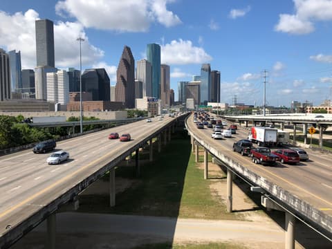
Traffic on the elevated North Freeway (I-45) approaches downtown Houston, seen from the I-10 connector ramp in July 2019.
Photo: Famartin, Wikimedia Commons (CC BY-SA 4.0)
Used on: Is I-45 the deadliest highway in America? Tracing a statistic;I-45 in Houston: traffic, congestion, safety and the NHHIP rebuild
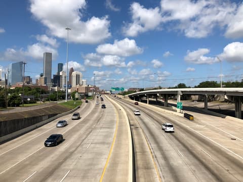
Interstate 10 runs west past downtown Houston in this July 2019 view from the McKee Street overpass.
Photo: Famartin, Wikimedia Commons (CC BY-SA 4.0)
Used on: I-10 in Houston: Katy Freeway traffic, safety and projects
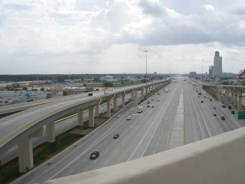
The rebuilt Katy Freeway (I-10) stretches east from the Sam Houston Tollway interchange near Gessner in 2009, with managed lanes running down the center.
Photo: Socrate76, Wikimedia Commons (CC BY-SA 3.0)
Used on: I-10 in Houston: Katy Freeway traffic, safety and projects
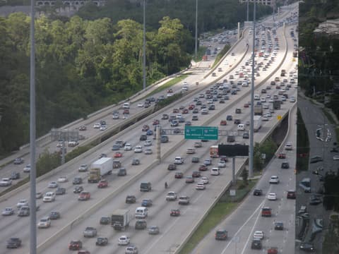
Traffic crowds the West Loop (I-610) just south of I-10 in this 2009 view from a nearby office tower.
Photo: Socrate76, Wikimedia Commons (CC BY-SA 3.0)
Used on: I-610 in Houston: the 610 Loop's congestion, trucks and Ship Channel bridge
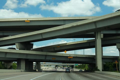
Flyover ramps stack above westbound I-10 at its interchange with the 610 Loop in May 2014.
Photo: formulanone, Wikimedia Commons (CC BY-SA 2.0)
Used on: I-10 in Houston: Katy Freeway traffic, safety and projects
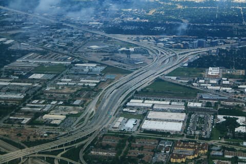
The 610 Loop between I-10 and U.S. 290 is shown from the air in October 2019.
Photo: formulanone, Wikimedia Commons (CC BY-SA 2.0)
Used on: I-610 in Houston: the 610 Loop's congestion, trucks and Ship Channel bridge
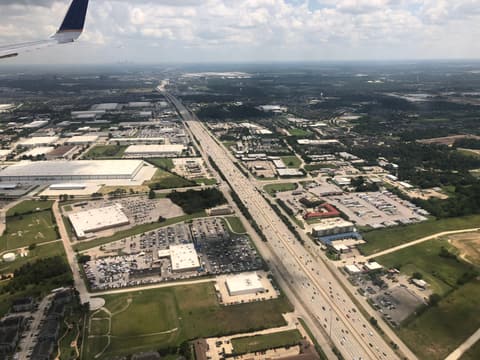
Interstate 45 runs south through north Houston near Exit 64, seen from a plane landing at Bush Intercontinental Airport in July 2019.
Photo: Famartin, Wikimedia Commons (CC BY-SA 4.0)
Used on: Houston's most dangerous highways: what the data can and cannot say;I-45 in Houston: traffic, congestion, safety and the NHHIP rebuild
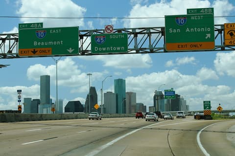
Guide signs on southbound I-45 point drivers to I-10 and downtown Houston in May 2014.
Photo: formulanone, Wikimedia Commons (CC BY-SA 2.0)
Used on: I-45 in Houston: traffic, congestion, safety and the NHHIP rebuild
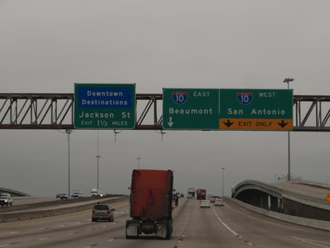
Guide signs on U.S. 59 direct traffic to I-10 and downtown Houston in January 2015.
Photo: Ken Lund, Wikimedia Commons (CC BY-SA 2.0)
Used on: Commercial vehicle safety in Houston: inspections, licensing, insurance and hazmat routes
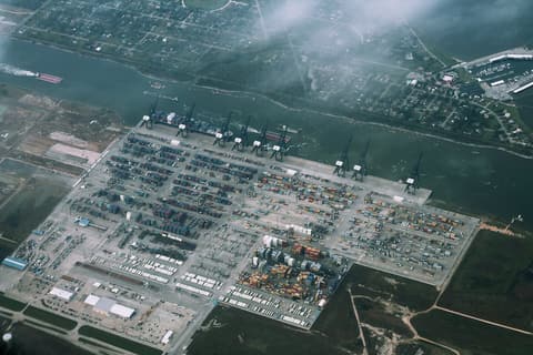
The Bayport Container Terminal near Houston is seen from the air in January 2016.
Photo: formulanone, Wikimedia Commons (CC BY-SA 2.0)
Used on: Port Houston and commercial truck traffic: containers, terminals and the roads that carry them
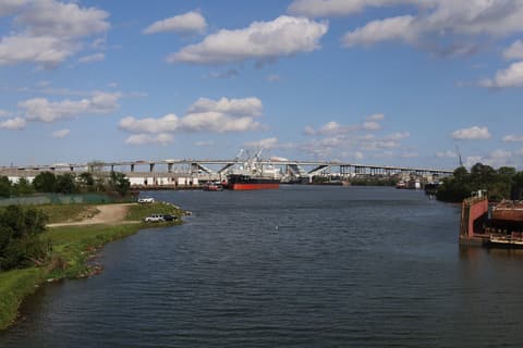
A bulk carrier and tug pass the Sidney Sherman Bridge on the Houston Ship Channel in March 2026.
Photo: Antony-22, Wikimedia Commons (CC BY-SA 4.0)
Used on: I-610 in Houston: the 610 Loop's congestion, trucks and Ship Channel bridge

Shipping containers fill a storage yard in Galena Park along the Houston Ship Channel corridor in July 2024.
Photo: Quintin Soloviev, Wikimedia Commons (CC BY 4.0)
Used on: Houston truck crash statistics: Harris County commercial vehicle crashes, 2015-2025
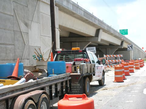
Barrels line an Interstate 10 work zone beneath a new overpass in June 2006.
Photo: Ed Schipul, Wikimedia Commons (CC BY-SA 2.0)
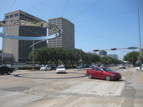
Traffic crosses the intersection of Westheimer Road and Post Oak Boulevard beside The Galleria in September 2009.
Photo: Rpclod, Wikimedia Commons (public domain)
Used on: Houston's most dangerous intersections: what the published rankings show
_from_the_ramp_between_westbound_Interstate_10_and_southbound_Interstate_45_in_Houston,_Harris_County,_Texas.jpg)
_from_the_overpass_for_McKee_Street_in_Houston,_Harris_County,_Texas.jpg)


.jpg)

_near_Exit_64_on_the_north_edge_of_Houston,_Harris_County,_Texas_from_an_airplane_landing_at_George_Bush_Intercontinental_Airport.jpg)
.jpg)

.jpg)


.jpg)
